Annual Grand River Cleanup: Volunteers Remove Two Tons of Trash from Designated Ohio Scenic River
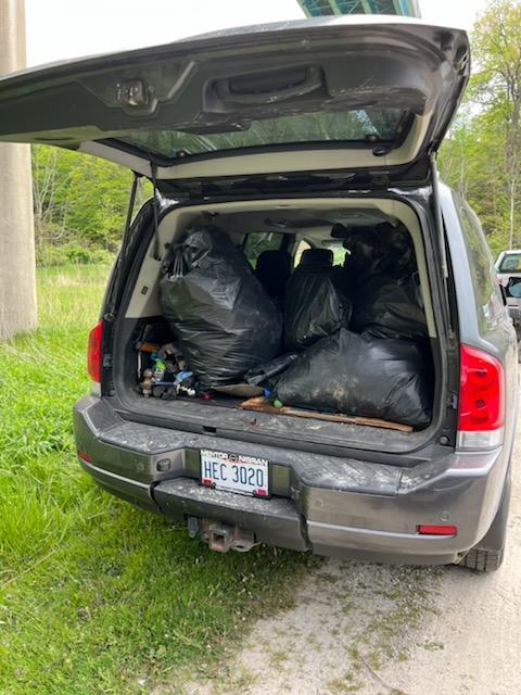
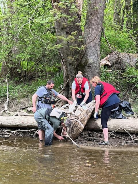
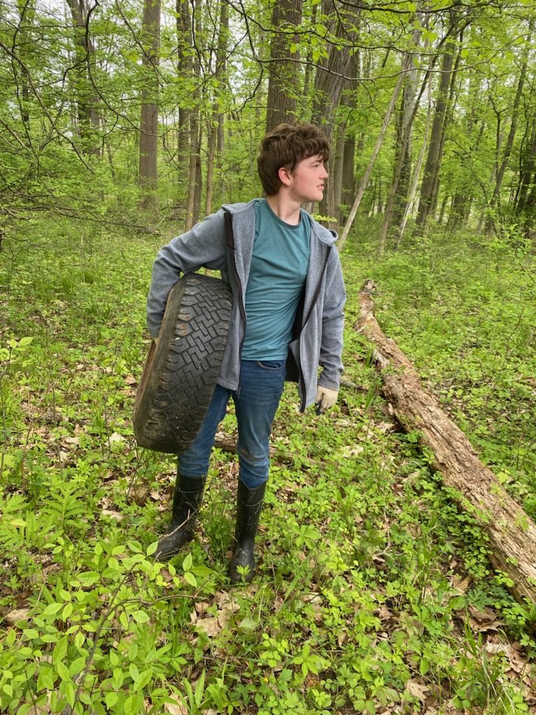
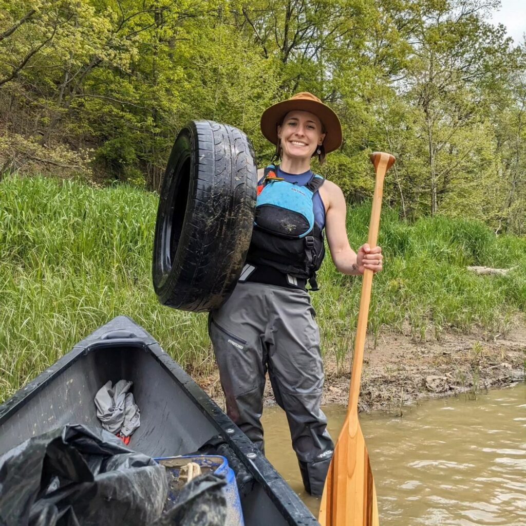
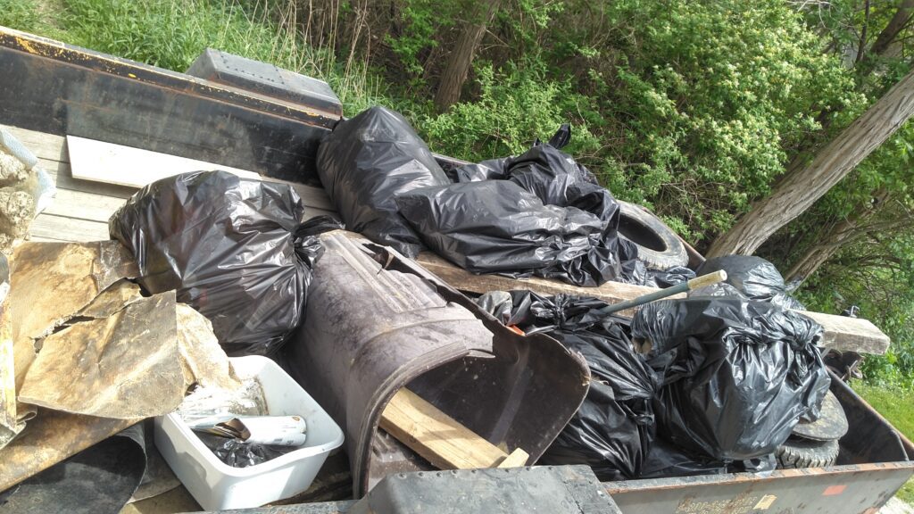
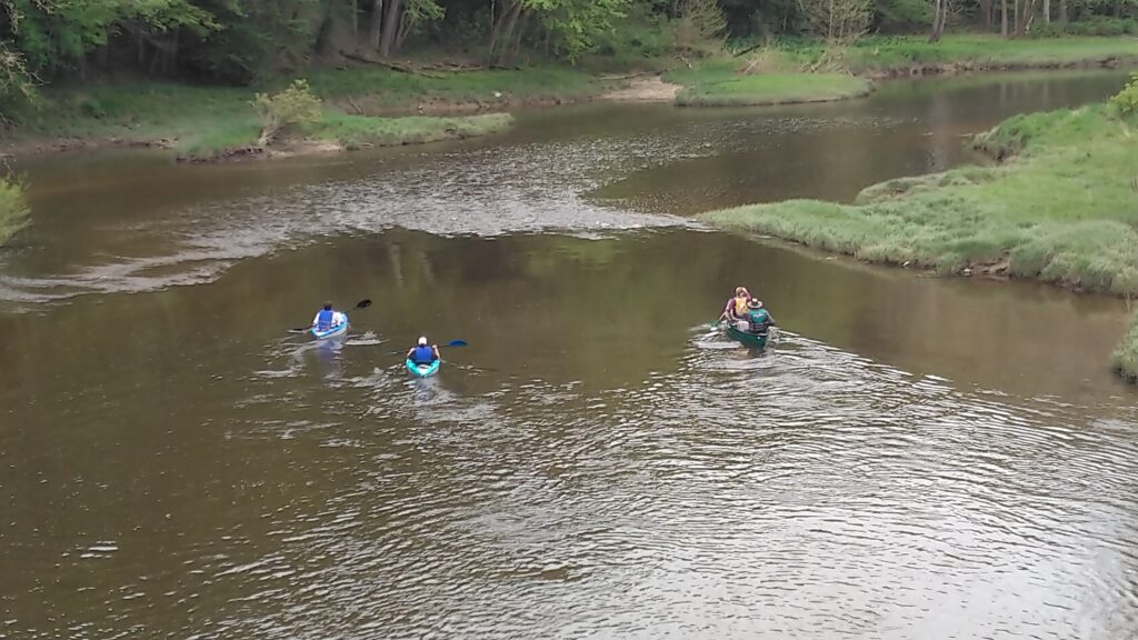
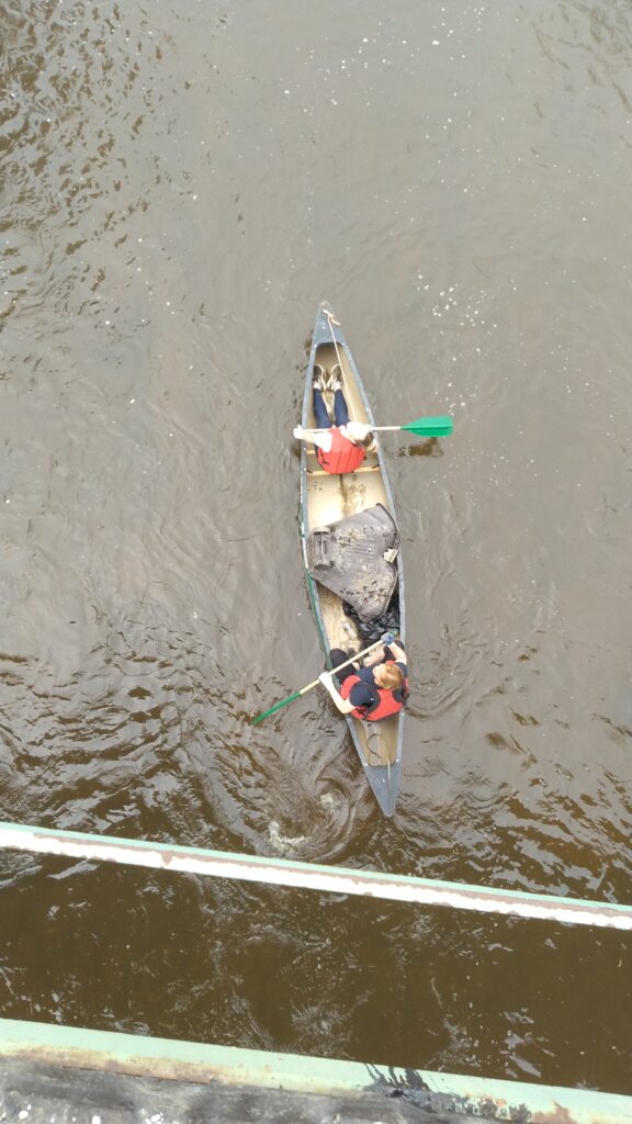
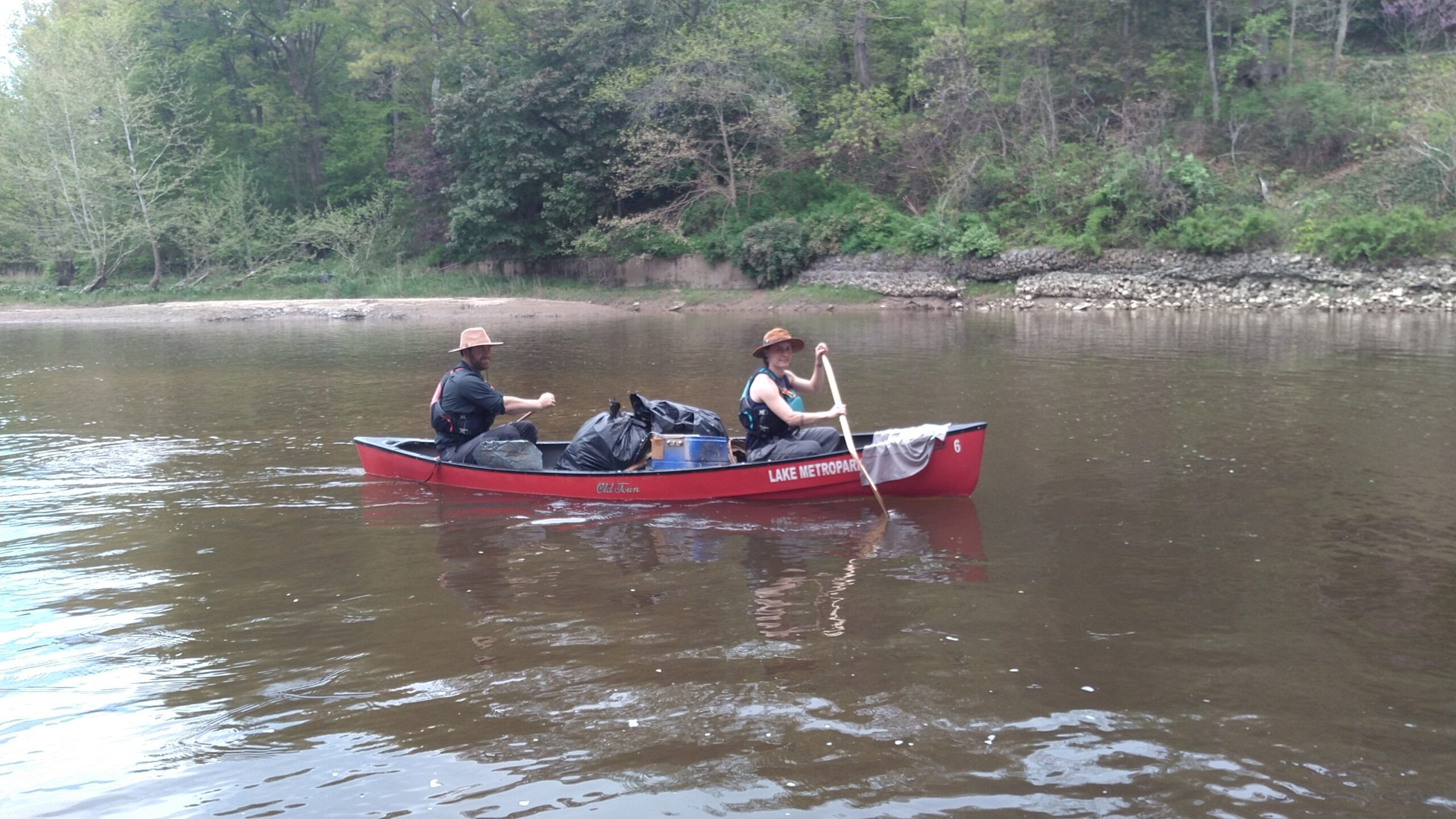
Three dozen staff and volunteers from Western Reserve Land Conservancy, the Ohio Department of Natural Resources (ODNR), Division of Natural Areas & Preserves, Scenic Rivers Program, Lake MetroParks, the Lake County Soil & Water District, the Ashtabula County Metroparks and the Ashtabula Soil & Water District continued the annual cleanup of trash and debris in and along the Grand River, one of Ohio’s designated Scenic Rivers last Saturday, May 13. From the shore and on the water, volunteers collected and removed approximately two tons of trash and seven used tires.
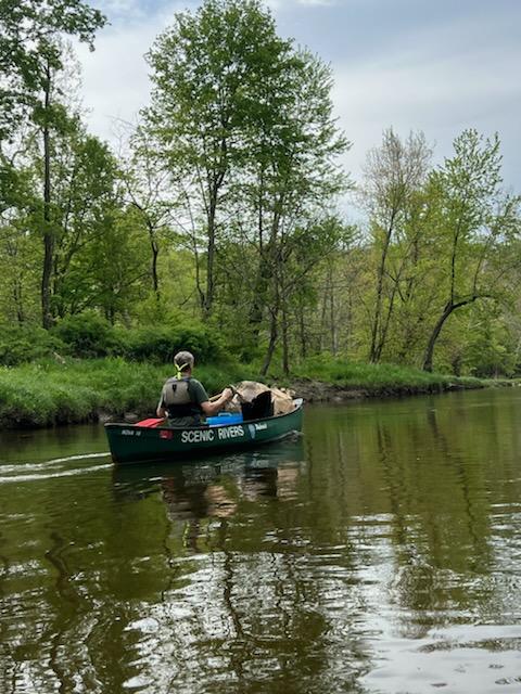
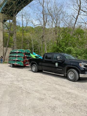
Thirty volunteers kayaked and canoed along two 8-mile float sections of the Grand River: the first section was from Harpersfield Covered Bridge Metropark in Harpersfield Township to Hidden Valley MetroPark in Madison Township; the second section was from Hidden Valley MetroPark to Indian Point Park in Leroy Township. Six additional volunteers worked along the roadside and shoreline of the river at the Wright-Davis Scenic River Area in Harpersfield, which, according to ODNR Scenic River personnel, has not been part of an organized cleanup effort in recent times.
The Grand River is one of only three rivers in Ohio – along with Conneaut Creek, primarily in Ashtabula County and Little Beaver Creek, primarily in Columbiana County – designated as both a State Scenic and Wild River. Northeast Ohio boasts seven of the 15 State Wild, Scenic and Recreational rivers. Like other Lake Erie tributaries in northeast Ohio, the Grand is noted for its steelhead and muskellunge fishing.
Grand River Partners Inc., a land trust that merged with Western Reserve Land Conservancy in 2010, began the annual cleanup tradition in 1999. By partnering with public and private landowners, the Land Conservancy has permanently protected 14.5 miles of land along the Grand River at 36 properties, including 1.2 miles of the river in the Ashcroft Woods Conservation Area, a 379-acre publicly accessible nature preserve that includes 103 acres of uninterrupted upland and floodplain forests. The oldest protected property dates back to 1996.
“Clean water begins on the land,” said George Warnock, eastern region land steward with Western Reserve Land Conservancy. “By permanently protecting land along the Grand River and other Ohio waters, we’re creating a buffer not only for the trash and debris you can see, but for the pollution and runoff you cannot see. I hope this annual tradition will continue for many generations to come.” Each organization contributed an important part to this year’s successful river cleanup:
- Lake MetroParks provided a staging venue at the Hidden Valley MetroPark Shelter where participants launched and landed canoes along the lower section of the Grand River float; a driver and shuttle to move participants; trash trailers to remove collected trash; and eight canoes, PFDs (personal flotation devices) and paddles;
- The Ohio Department of Natural Resources, Division of Natural Areas & Preserves, Scenic Rivers Program, provided eight canoes, PFDs and paddles plus two staff who led the upper section float;
- The Ashtabula Soil & Water District led the ground cleanup at the Wright-Davis Scenic River Preserve in Harpersfield;
- The Ashtabula County Metroparks provided a venue for staging and launching along the upper section of the Grand River float.
“The removal of litter from the Grand River Wild and Scenic River and adjacent lands not only protects the outstanding water quality and ecology of the river, but it also enhances the feeling of wildness that these backcountry areas provide for those who visit them,” says Jeffry Hayes, Assistant Regional Scenic Rivers Manager for NE Ohio. “The Ohio Scenic Rivers Program is proud to support these efforts.”
According to the Ohio Department of Natural Resources: The 102-mile long Grand River rises in Parkman Township (Geauga County) and initially flows eastwardly into neighboring Farmington Township (Trumbull County) before meandering northward toward Ashtabula County. In Austinburg Township (Ashtabula County) the river sharply turns west. Its westward stretch nearly parallels the Lake Erie shore for roughly 25 miles before making a northward turn in Painesville (Lake County). The lowermost 10 miles wind through Painesville, Fairport Harbor, (the village of) Grand River and Painesville Township. The river mouth is at Fairport Harbor. The Grand River Watershed drains 712 square miles (455,680 acres), including portions of Ashtabula, Geauga, Lake, Portage and Trumbull counties.
Ohio’s first state nature preserve, Mentor Marsh, a designated National Natural Landmark, occupies the former Grand River channel between Mentor Lagoons in Mentor and River Mile 1 of the river’s existing course. The old mouth at Mentor Lagoons is located roughly 4.5 miles west of its current mouth at Fairport Harbor. Erosion from Lake Erie scoured a sufficient amount of land near present-day Headlands Beach State Park and caused a breach in the river, thus creating a new outlet. As a result, the redirected watercourse gradually transformed the abandoned river channel into marshland. Today, the 673-acre Mentor Marsh State Nature Preserve encompasses one of the largest remaining natural marsh areas along the Lake Erie shore.
The Grand River was once known as the Sheauga River, which is a variation of the Native American word “Geauga” meaning “raccoon.” The river has also been referred to as the Chereage River and Chocago River.
Owing to an amenable microclimate, the Grand River Valley region is suitable for grape growing and wine production. The valley’s proximity to Lake Erie allows for the effective circulation of warmer air, which as a result reduces the threat of frost in the spring and extends the growing season. Additionally, the gently sloping topography of the valley efficiently prevents water from oversaturating the grapevines. The Grand River Valley is recognized as an American Viticultural Area by the U.S. Department of Treasury.
In Ashtabula County, three covered bridges span the Grand River, including the Harpersfield Bridge, the Mechanicsville Road Bridge and the Riverdale Road Bridge. The Mechanicsville Road Bridge, built in 1867, is the oldest covered bridge in the county.